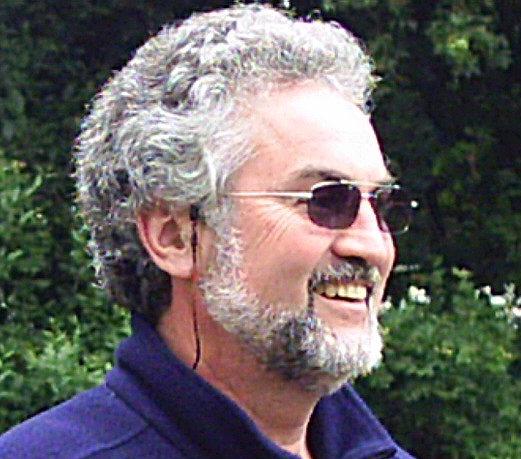
Don Feidner

Last Update:  30 August 2015

Zurück zur Hauptseite!

1 Westerland and Braderup

2 Keitum and Morsum

3 List, Kampen and Wenningstedt

4 Ellenbogen -
The Elbow

5 Romo

6 Rantum and Hörnum

7 Hallig Hooge

8 Denmark

9 Sylt Wattland to Hamburg

10 Elbe in Hamburg to Home in Hessen

Map Denmark

The green line markes my route. As you can see, I first headed north. The open treasure chests mark the geocaches that I found.

P1240552
P1240554

The road next to the dike was empty and the fresh air smelled good - well, that is, except for the odor of cow dung. Along the dike, there were more sheep than cows.

P1240556

The view to the ocean is somehow romantic. Miles of open sea and a haze of mist hanging in the air.

P1240558

This stone commemorates the cooperation between the Germans and Danes in building this dike near the border of the 2 countries.

P1240560

Tonder  is a Danish municipality (Kommune) on the Jutland peninsula in south Denmark. It covers an area of 1,278 km², and has a total population of 40,367. See area in red to the right. The island is the Island of Romo.

P1240561

The bicycle trails were well marked near the border to Denmark. In Denmark itself, they were sometimes very colorful and in English.

P1240563
P1240566

This national park appeared to be filled with sheep and cattle.

P1240569

Tourist Attraction?  Nope, Just an Ordinary Picnic Area in Denmark

By the way, a geocache was hidden in this hut made of reed and wood. I ate lunch inside and looked for 20 minutes before I found it.

P1240573
P1240576
P1240577

This Danish Windmill was also a pastry and coffee shop with pastry and bread made from grain milled in the shop.

P1240580

So I went the long way, 2 km down the road, then to this cliff.

P1240582

Inland was a network of canals.

P1240586

A Day in Denmark

Why only a day? I was still in the rehab clinic on the island of Sylt and was not really allowed to leave the island. OK, I cheated, but I was getting island fever and decided to take the train to the mainland and just ride my bike for a day through the part of DEnmark just north of the German border.

P1240551

Cattle - As Far As the Eye Can See

P1240553
P1240555

The wind on the coast of Denmark is constant and strong, which means a guaranteed means of electricity production.

P1240557
P1240559

Border Marker - German Kingdom (Das Deutsche Reich)

Denmark Tonder
P1240562
P1240564
P1240567

The border crossing furthest west on the German/Danish border has an interesting story. At this point there was a round bar gate, like at many border crossings today. For decades, it was only possible  to cross this border with special permission. Initially, it caused a lot of problems, because it was far away from any towns and in the middle of a very deserted area of the country. It was especially a problem for Bauer Broder P who lived on a farm on the Danish side of the border - but the road that led to it was on the German side of the border. That meant that every trip he made to and from his farm, he had to cross the border twice. To go to the next Danish village, Rodenaes, in his car , he had to unlock the border gate and raise it, cross over, put it back down and lock it again. Then he had to take a long detour to go to the next official border crossing to get permission to go through it and continue back to the village. Eventually, he got revenge by just leaving it open. What happened then? You can guess the rest of the story.

P1240570
P1240575

The chamber in  this passage grave mound is built up of 10 supporting stones and 3 cap stones. It has a 4-meter long narrow passageway.

The grave mound was excavated and restored in 1914. Large stones several meters in height stood around the location of the original burial mound. Hundreds of years later when the mound's soil had covered all the stones, the burial mound was built up to increase its size and a fresh row of smaller circle stones were placed on top of the old ones. Among these stones was a cresset stone with 15 cup marks and some figures intertwined with one another; you can see them in the National Museum.

The passage grave was used for burials during three historical periods with intervals of 1000 years. A one centimeter layer of completely decomposed skeletal fragments was found on the floor of the chamber along with 75 amber beads. One thousand years later they had been covered with a layer of earth 20-40 cm thick and new corpses were then buried on top of that, along with various objects including 8 flint daggers. During the late Bronze Age, this passage grave was used as a burial place for the last time. This time it was an urn with traces of burnt bone and some bronze jewelry which were buried in the mound right next to the passageway. The mound has not been excavated completely so there are very likely more urn graves inside. It was last restored in 1990.

Bring a flashlight if you plan to visit it.   I always carry a bright LED flashlight in my handlebar bag.

P1240578

I began looking for a geocache that was near the trees far away in this field. When I got to the trees, I found --a cliff with a drop-off

P1240579
P1240581

Then the tide came in and revealed this beautiful view toward Sylt.

P1240583

The villages didn’t impress me much except for the buildings that were topped with a roof made of reed.

It was getting late and I had cycled far that day, nearly 100 kilometers (60 miles) by the time I reached the German border (left). So I headed for the train station that would get me back onto the island in a hurry. This time, I took the train all the way back to Westerland because my legs were tired.

Continue to the RIDE BACK HOME from Sylt to Hamburg

["Ride into the Future"] [Fahrt in die Zukunft] [Sponsors] [Bike Touring] [Questions] [About Don] [Trips] [AUSTRIA SWISS] [CZECH] [Danube River] [GERMANY] [Holland] [ITALY] [FRANCE] [Romania] [Spain Portugal] [UK] [USA] [Tours Near My Home] [Other Trips] [Longest Ride] [Health] [Book]

RETURN to Don Feidner’s
HOME PAGE