|
|
|
|
|
|
|
|
|
|
|
|
|
|
|
|
|
|
|
|
|
|
|
|
|
|
|
Danube - Leg 1 - 230 kilometers
Donau - Etappe 1 - 230 Kilometer
|
|
|
|
Ulm, not shown on the map to the right, is a beautiful university city located about halfway between Stuttgart and Munich.
|
|
|
|
 |
|
|
|
 |
|
|
Brigach near St. Georgen
|
|
|
|
This stream is called the Brigach, which when it joins the Breg 30 kilometers downstream, becomes the Danube - or so it seems. More about this later.
|
|
|
Dieses Bach wird “Brigach” genannt, das wenn es zusammen mit dem Breg in Donaueschingen zusammenfliesst, zur Donau wird -- oder so scheint es. Mehr darüber später..
|
|
|
 |
|
Bike Trail near Villingen in the Black Forest
|
|
|
|
The blue-green hole on the right is in Donaueschingen and has words engraved in stone claiming it to be the source of the Danube River. The water that flows out of this hole in the ground indeed flows into the Danube in the city where the Breg and Brigach meet along with many other tiny streams. The inscription also says that it is 2840 kilometers from this point to the Black Sea. That is undisputed.
|
|
|
|
Dieses blaugrün Topf auf der rechten Seite ist in Donaueschingen. Wörter in Stein behaupten es ist die Donauquelle. Das Wasser, das herausfliesst geht tatsächlich in die Donau wo der Brigach und Breg in Donaueschingen zusammenfliessen zusammen mit vielen anderen kleinen Bächen.Es steht auch geschrieben, dass die Donau 2840 Kilometer später ins Schwarze Meer hinein fliesst. Niemand wird das widersprechen.
|
|
|
|
 |
|
|
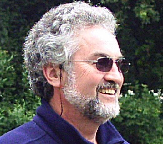
Pierre
|
|
|
|
This is where everything gets more complicated. At this point, the Danube River disappears, that is, it drops into a sinkhole to become an underground river and then reappears 3 days later in another river known as the Aach, which flows into Lake Constance, from there into the Rhine and then to the Atlantic.
So, the question is this: Is Donaueschingen the source of the Danube or not? Well, no!!! ... and yes!!!! Because during most of the Autumn, Winter and Spring, there is enough water in the riverbed for the Danube to continue to the Black Sea. But in the summer, the source of the Danube becomes other small streams that run into the Danube riverbed.
Therefore, the water from the real source of the “original” Danube flows 2 directions and the map should look like the one below.
|
|
|
|
An dieser Stelle wird alles viel komplizierter. Hier, die Donau versinkt. Also, das Wasser fällt tatsächlich in ein Höhlensystem als ein Untergrund Fluss und erscheint 3 Tage später und 12 kilometer weiter in einem anderen Fluss, der Aach, der dann in den Bodensee fliesst. Von dort, geht’s weiter in den Rhein und ins atlantische Ozean.
Daher, die Frage ist dies: Ist Donaueschingen wirklich die Donauquelle oder nicht? Die Antwort ist JEIN!!! Denn im Herbst, Winter und Frühling ist genug Wasser im Flussbett damit die Donau ins Schwarze Meer fliesst. Aber im Sommer wird die Quelle der Donau andere kleine Bäche, die in die Donau hinein fliessen.
Daher, das Wasser von der echten Quelle der “ursprunglichen” Donau fliesst in 2 Richtungen und die Karte von der Donau sollte aussehen wie unten.
|
|
|
|
 |
|
|
 |
|
|
Möhringen City Hall
|
|
|
|
 |
|
|
|
Searching for a Campsite near Mühlheim
|
|
|
|
 |
|
|
|
At 6 a.m. Pierre is still fast asleep.
|
|
|
|
 |
|
|
Mary Worship Chapel in a Grotto
|
|
|
 |
|
|
Yours Truly near Beuron
|
|
|
|
 |
|
|
Flowers Along the Cycling Trail
|
|
|
|
 |
|
|
|
 |
|
|
|
 |
|
|
|
Danube Between Beuron and Sigmaringen
|
|
|
|
 |
|
|
 |
|
|
A Very Beautiful Section
of the Danube River
|
|
|
|
 |
|
|
 |
|
|
Sigmaringen
|
|
|
|
 |
|
|
|
Palace in Sigmaringen
|
|
|
|
 |
|
|
View from Ehingen
|
|
|
|
 |
|
|
 |
|
|
Pierre - Nearing Ulm
|
|
|
|
 |
|
|
|
Yours Truly - Nearing Ulm
|
|
|
|
 |
|
|
Pierre in Ulm Pedestrian Zone
Behind him is the tallest church tower in the world.
|
|
|
|
 |
|
|
Ulm - Fisherman’s Quarter
|
|
|
|
 |
|
|
|
Pierre Adieu - On the way to Bratislava
|
|
|
|
|
|
“And so it begins”... or, perhaps, I should say. “So it ends”... because this section of the Danube is the last I cycled after completing the other segments in previous years. In 2006, I began the cycling trip on the Danube Northwest of Straubing and headed to Deggendorf. One week later, the trip continued on to Passau. One year later, I took the train to Ulm and peddled to Walhalla near Regensburg where I first joined the Danube the year before. In 2011, I continued the trip with my wife’s cousin, Rudi Wandersleb, peddling from Passau, Germany, to Vienna, Austria; Budapest, Hungary and Belgrade in Serbia. In 2012, I completed this tour by traveling from Belgrade to the Black Sea, then from the source of the Danube to Ulm.
|
|
|
|
“Hier fängt’s an”... oder, vielleicht sollte ich sagen, “Hier endet die Sache”... denn diese Etappe der Donau ist die letzte Etappe, die ich geradelt bin, nachdem ich die andere Etappen in anderen Jahren vorher gemacht hatte. In 2006, radelte ich von Straubing bis Deggendorf. Eine Woche später, ging die Reise nach Passau. Ein Jahr später, fuhr ich von Ulm bis Walhalla in der Nähe von Regensburg, wo ich ein Jahr vorher an der Donau war. In 2011, bin ich mit dem Cousin meiner Frau von Passau nach Wien, Bratislava, Budapest und Belgrad geradelt. In 2012, ging die Radwanderung von Belgrad weiter bis zum Schwarzen Meer, dann von der Donauquelle bis Ulm.
|
|
|
|
Bike Trail near Villingen in the Black Forest
|
|
|
|
Source of the Danube - Der Blaue Topf - Donaueschingen
|
|
|
|
Pierre and I met in Donaueschingen and instantly became friends. I had ridden with a lady, who had lost her way on the way down from St. Georgen, when we ran into Pierre. She was headed for Lake Constance in the south without a map, so I helped her find the way to the correct bicycle trail and continued on the Danube trail with Pierre.
Pierre, a French gentleman who works in a company that provides equipment for nuclear safety, was on his way to Bratislava, in the Slovakian Republic. His English is better than my French, so most of our communications were in English. We rode for quite a distance together and eventually, we decided to continue together all the way to Ulm.
|
|
|
|
Pierre und ich haben uns in Donaueschingen kennengelernt und sind sofort Freunde geworden. Ich war vorher mit einer Dame, die sich mehrmals verfahren hatte auf dem Weg von St. Georgen als wir Pierre gesehen hatten. Sie wollte zum Bodensee ohne eine Landkarte. Daher habe ich ihr geholfen den richtigen Radweg zu finden und bin mit Pierre auf dem Donauweg weitergefahren.
Pierre, ein französicher Gentleman, der in einer Firma arbeitet, wo Nuklearsicherheit Hauptthema ist, war auf den Weg nach Bratislava, in der Slovakei. Sein Englisch ist besser als mein Französich, daher haben wir uns hauptsächlich auf Englisch unterhalten. Wir sind ziemlich weit zusammen gefahren, und sind den ganzen Weg nach Ulm zusammen geblieben.
|
|
|
|
Pierre in the Disappearing Danube
|
|
Not only is there a leaning tower in Pisa, Italy.
There is also a leaning tower in Ulm.
|
|
Ulm City Hall - The New Meets Old
|
|